Fishing Footprints
A collection of commercial fishing activity maps
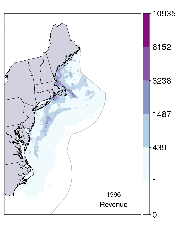
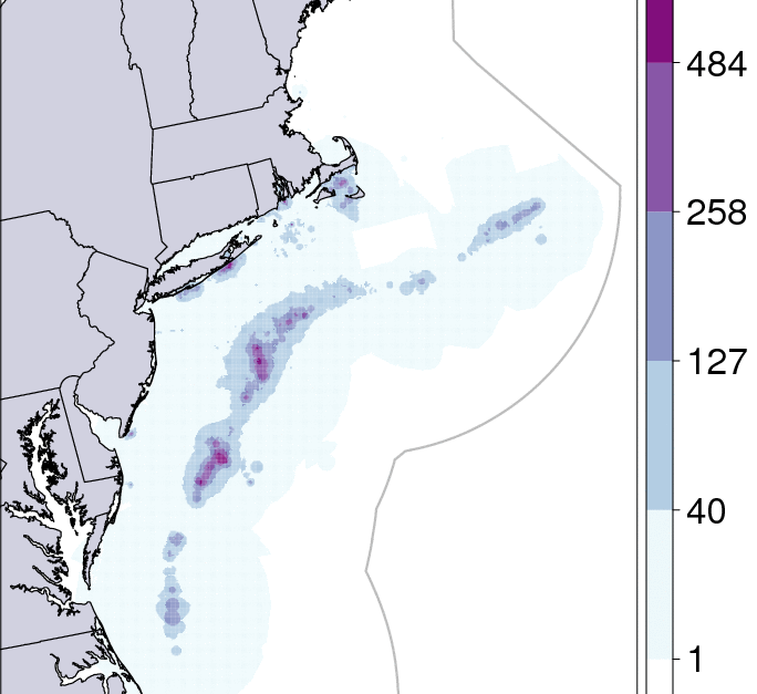
For more information on the method by which VTR data was interpreted to create this database of fishing activity maps, please see DePiper (2014) and Benjamin et al. (2017, pending publication). Commercial fishing activity is categorized using Jenks' Natural Breaks into 5 classes. All maps are plotted in North American Datum 1983 (NAD83). Revenue figures are real (2014) US dollars.
In order to comply with the data confidentiality requirements required under the Magnuson-Stevens Act, features with fewer than three contributing vessels have been obscured. For some species and year combinations, a map cannot be presented.